Caldera Depression

Topographic Features

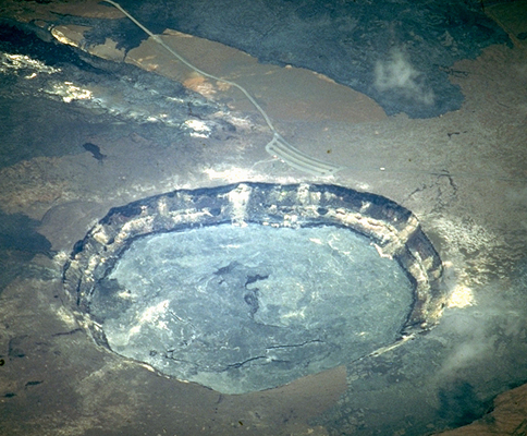
Calderas form from the catastrophic eruption of large amounts of felsic lava and ash. Emptying of the magma chamber and subsequent collapse of the overlying volcanic edifice forms a ring-shaped caldera depression up to several kilometers in diameter. The edges of the underlying magma chamber are roughly marked by a ring fracture zone that acts as a conduit for ongoing volcanism and hydrothermal activity.
Calderas are capable of expelling large amounts of volcanic material in a single eruptive event, leaving behind regionally extensive ash fall deposits. For example, the Bishop Tuff, deposited during the eruption of the Long Valley Caldera 767,100 ± 900 years ago, covers a 2,200 square-kilometer region of the southwestern United States.
Examples
Want to add an example to this list? Select a Geothermal Resource Area to edit its "Topographic Features" property using the "Edit with Form" option.
| Geothermal Resource Area | Geothermal Region | Tectonic Setting | Host Rock Age | Host Rock Lithology | Mean Capacity | Mean Reservoir Temp |
|---|---|---|---|---|---|---|
| Fenton Hill HDR Geothermal Area | Rio Grande Rift | Rift Zone Extensional Tectonics | Precambrian | Crystalline basement “pCu” (undifferentiated in map units); Biotite Granodiorite (Phase I Reservoir); Gneiss, Schist, Granodiorite, Granite, Metavolcanic Rocks (Phase II Reservoir) | 20 MW20,000 kW <br />20,000,000 W <br />20,000,000,000 mW <br />0.02 GW <br />2.0e-5 TW <br /> | 508.15 K235 °C <br />455 °F <br />914.67 °R <br /> |
| Fukushima Geothermal Area | Northeast Honshu Arc | Subduction Zone | 65 MW65,000 kW <br />65,000,000 W <br />65,000,000,000 mW <br />0.065 GW <br />6.5e-5 TW <br /> | 579.15 K306 °C <br />582.8 °F <br />1,042.47 °R <br /> | ||
| Hachijojima Geothermal Area | Northeast Honshu Arc | Subduction Zone | 3.3 MW3,300 kW <br />3,300,000 W <br />3,300,000,000 mW <br />0.0033 GW <br />3.3e-6 TW <br /> | 556.15 K283 °C <br />541.4 °F <br />1,001.07 °R <br /> | ||
| Lahendong Geothermal Area | Minahasa Volcanic Zone | Subduction Zone | Miocene | Andesite | 80 MW80,000 kW <br />80,000,000 W <br />80,000,000,000 mW <br />0.08 GW <br />8.0e-5 TW <br /> | 578.15 K305 °C <br />581 °F <br />1,040.67 °R <br /> |
| Lihir Geothermal Area | Papua New Guinea Geothermal Region | Subduction Zone | Basalt; Breccias; Tuffs | 56 MW56,000 kW <br />56,000,000 W <br />56,000,000,000 mW <br />0.056 GW <br />5.6e-5 TW <br /> | 548.15 K275 °C <br />527 °F <br />986.67 °R <br /> | |
| Miyagi Geothermal Area | Northeast Honshu Arc | Subduction Zone | Miocene | Basalt | 12.5 MW12,500 kW <br />12,500,000 W <br />12,500,000,000 mW <br />0.0125 GW <br />1.25e-5 TW <br /> | 523.15 K250 °C <br />482 °F <br />941.67 °R <br /> |
| Mokai Geothermal Area | Taupo Volcanic Zone | Extensional Tectonics Subduction Zone | Quaternary | Volcaniclastic | 112 MW112,000 kW <br />112,000,000 W <br />112,000,000,000 mW <br />0.112 GW <br />1.12e-4 TW <br /> | 568.15 K295 °C <br />563 °F <br />1,022.67 °R <br /> |
| Mori Geothermal Area | Kuril-Kamchatka Arc | Subduction Zone | Pre-Tertiary | Limestone | 50 MW50,000 kW <br />50,000,000 W <br />50,000,000,000 mW <br />0.05 GW <br />5.0e-5 TW <br /> | 513.15 K240 °C <br />464 °F <br />923.67 °R <br /> |
| Pauzhetskaya Geothermal Area | Kuril-Kamchatka Arc | Subduction Zone | Tuff | 27 MW27,000 kW <br />27,000,000 W <br />27,000,000,000 mW <br />0.027 GW <br />2.7e-5 TW <br /> | 468.15 K195 °C <br />383 °F <br />842.67 °R <br /> | |
| Sumatra-Sibayak Geothermal Area | Sunda Volcanic Arc - Great Sumatra Fault Zone | Subduction Zone | Tertiary | Sandstone; Limestone | 12 MW12,000 kW <br />12,000,000 W <br />12,000,000,000 mW <br />0.012 GW <br />1.2e-5 TW <br /> | 543.15 K270 °C <br />518 °F <br />977.67 °R <br /> |
| Valles Caldera - Redondo Geothermal Area | Rio Grande Rift | Rift Zone Extensional Tectonics | Mississippian-Pennsylvanian; Pleistocene, 1.6 to 1.25 Ma | Limestone-Madera Formation “MIPu”; Rhyolitic tuff-Intracaldera Bandelier Tuff (upper Tshirege “Qbt” and lower Otowi “Qbo” members); Caldera Fill Rhyolite (shallow) | ||
| Valles Caldera - Sulphur Springs Geothermal Area | Rio Grande Rift | Rift Zone Extensional Tectonics | Precambrian; Mississippian-Pennsylvanian; Pleistocene, 1.6 to 1.25 Ma; Pliocene; Miocene | Crystalline basement “pCu”; Limestone-Madera Formation “MIPu”; Rhyolitic tuff-Bandelier Tuff (upper Tshirege “Qbt” and lower Otowi “Qbo” members); Caldera Fill Rhyolite (shallow); Dacitic/Andesitic to Rhyolitic lavas and tuffs-Keres Group Volcanics (shallow); Santa Fe Group volcaniclastics “Tsf” | ||
| Wairakei-Poihipi Geothermal Area | Taupo Volcanic Zone | Extensional Tectonics Subduction Zone | Quaternary | Volcaniclastic | 352 MW352,000 kW <br />352,000,000 W <br />352,000,000,000 mW <br />0.352 GW <br />3.52e-4 TW <br /> | 483.15 K210 °C <br />410 °F <br />869.67 °R <br /> |